


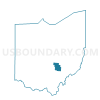
COAL Voting District, Perry County, Ohio
About
Outline

Summary
| Unique Area Identifier | 650950 |
| Name | COAL Voting District |
| County | Perry County |
| State | Ohio |
| Area (square miles) | 12.41 |
| Land Area (square miles) | 12.39 |
| Water Area (square miles) | 0.02 |
| % of Land Area | 99.81 |
| % of Water Area | 0.19 |
| Latitude of the Internal Point | 39.57457120 |
| Longtitude of the Internal Point | -82.21597790 |
Maps


Graphs
Select a template below for downloading or customizing gragh for COAL Voting District, Perry County, Ohio


Neighbors
Neighoring Voting District (by Name) Neighboring Voting District on the Map
- HEMLOCK Voting District, Perry County, OH
- MONDAY CREEK Voting District, Perry County, OH
- MONROE Voting District, Perry County, OH
- NEW STRAITSVILLE Voting District, Perry County, OH
- PRECINCT CARBON HILL, Hocking County, OH
- PRECINCT FALLS 2, Hocking County, OH
- PRECINCT MURRAY CITY, Hocking County, OH
- SALTLICK Voting District, Perry County, OH
- SHAWNEE Voting District, Perry County, OH
- Voting District TRIMBLE TOWNSHIP, Athens County, OH
Top 10 Neighboring County Subdivision (by Population) Neighboring County Subdivision on the Map
- Falls township, Hocking County, OH (11,731)
- Trimble township, Athens County, OH (4,480)
- Ward township, Hocking County, OH (1,933)
- Monroe township, Perry County, OH (1,508)
- Salt Lick township, Perry County, OH (1,262)
- Coal township, Perry County, OH (1,042)
- Monday Creek township, Perry County, OH (727)
Top 10 Neighboring Place (by Population) Neighboring Place on the Map
Top 10 Neighboring Unified School District (by Population) Neighboring Unified School District on the Map
- Logan-Hocking Local School District, OH (24,026)
- Nelsonville-York City School District, OH (9,729)
- Southern Local School District, OH (4,814)
- Trimble Local School District, OH (4,621)
Top 10 Neighboring State Legislative District Lower Chamber (by Population) Neighboring State Legislative District Lower Chamber on the Map
Top 10 Neighboring State Legislative District Upper Chamber (by Population) Neighboring State Legislative District Upper Chamber on the Map
Top 10 Neighboring 111th Congressional District (by Population) Neighboring 111th Congressional District on the Map
Top 10 Neighboring Census Tract (by Population) Neighboring Census Tract on the Map
- Census Tract 9663, Perry County, OH (6,150)
- Census Tract 9726, Athens County, OH (4,483)
- Census Tract 9655, Hocking County, OH (4,286)
Top 10 Neighboring 5-Digit ZIP Code Tabulation Area (by Population) Neighboring 5-Digit ZIP Code Tabulation Area on the Map
- 43138, OH (18,437)
- 45732, OH (4,776)
- 43730, OH (2,503)
- 43766, OH (1,648)
- 43782, OH (849)
- 43144, OH (477)